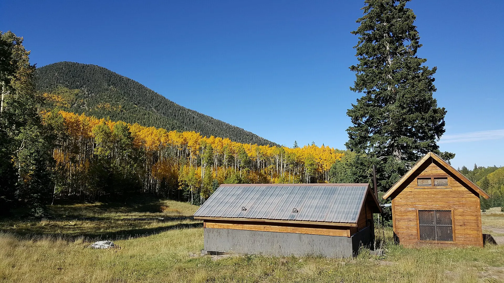
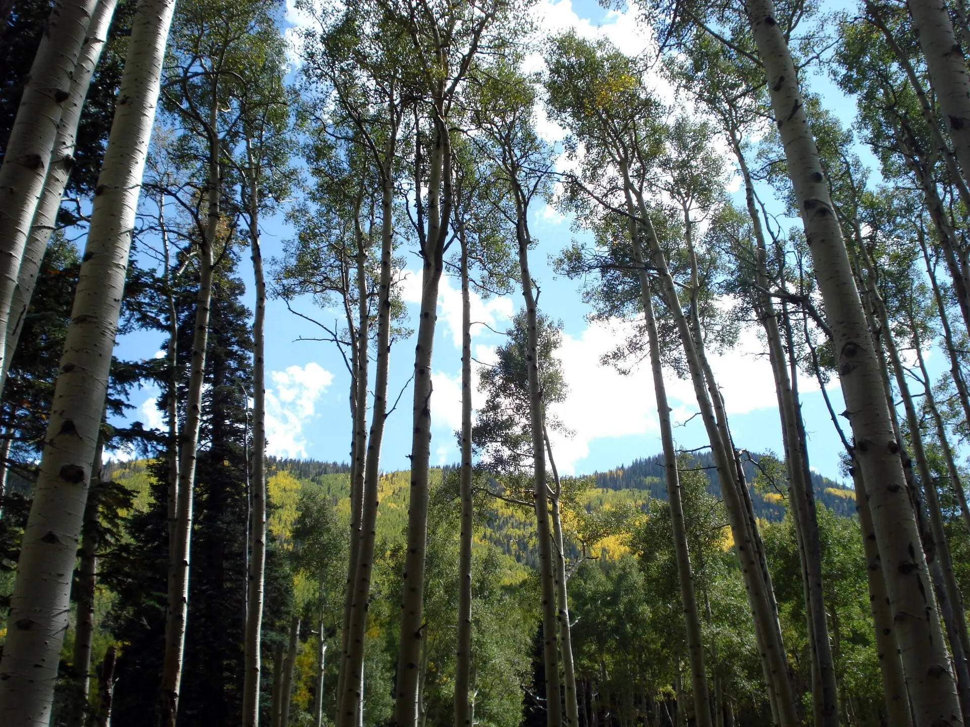
Golden aspen in the Inner Basin of the San Francisco Peaks
Hiking

Hiking in Flagstaff

Most Flagstaff trailheads are within half an hour of downtown, from a one-hour aspen loop to the summit of Arizona. Dogs on a leash are welcome on the forest trails, and Lockett Meadow's road is closed for now.

Some links on this page are affiliate links. If you book through them, we earn a commission at no extra cost to you. It doesn't change what we recommend. How we make money

See the trails
Checked November 7, 202617 trailsTrailheads up to 9,340 ft

Inner Basin, late September · Photo: Coconino National Forest / Wikimedia Commons, CC0 1.0 · Credits

Mountain trails

The big climbs on the San Francisco Peaks

The Humphreys and Kachina trails start at Snowbowl, above 9,000 feet; Elden Lookout and Schultz Creek start at the edge of town.

  • Humphreys Trail

    Trailhead and drive from downtownLower Snowbowl lot, about 14 miLength5–5.5 mi one wayElevation change3,420 ftDogsOn a leash
  • Kachina Trail

    Trailhead and drive from downtownSnowbowl, first lot on the right, about 14 miLength5.2 miElevation change1,188 ft up and downDogsOn a leash
  • Weatherford Trail

    Trailhead and drive from downtownForest Road 420 (closed in winter)Length10.4 mi one wayElevation change3,740 ftDogs–
  • Inner Basin Trail

    Trailhead and drive from downtownLockett MeadowLength3.9 miElevation change2,336 ftDogs–
  • Abineau Trail

    Trailhead and drive from downtownNorth side of the Peaks, about 25 miLength2.4 miElevation change2,729 ftDogs–
  • Bear Jaw Trail

    Trailhead and drive from downtownSame trailhead as AbineauLength2.8 miElevation change1,312 ftDogs–
  • Elden Lookout Trail

    Trailhead and drive from downtownUS 89 by the Flagstaff Mall, about 5 miLength3 miElevation change2,392 ftDogsOn a leash
  • Schultz Creek Trail

    Trailhead and drive from downtownSchultz Creek Trailhead, about 4 miLength4.5 mi one wayElevation change916 ftDogs–

Humphreys Peak in detail

Easy hikes

Shorter walks with a big view

The Aspen Nature Loop starts at the same lower Snowbowl lot as the Humphreys Trail, at about 9,270 feet, and takes about an hour. Walnut Canyon and Sunset Crater have short trails past cliff dwellings and across a lava flow.

Yellow aspen leaves in Lockett Meadow in fall
Aspen in fall below the San Francisco Peaks.Lockett Meadow · Photo: Brian Deck, Coconino National Forest / Wikimedia Commons, CC BY-SA 2.0

Walnut Canyon Sunset Crater

  • Aspen Nature Loop

    StartLower Snowbowl lotLength1.8 mi, about an hourClimb or good to knowEasy to moderate, about 300 ft
  • Fatman's Loop

    StartUS 89 by the Flagstaff MallLength2.5-mile loopClimb or good to know600 ft
  • Sandys Canyon Trail

    StartLake Mary Road, about 8 miLength1.3 mi one wayClimb or good to know338 ft
  • Island Trail, Walnut Canyon

    StartWalnut Canyon visitor centerLength1 mile round trip, about an hourClimb or good to know185 ft down, 240 steps
  • Rim Trail, Walnut Canyon

    StartWalnut Canyon visitor centerLength0.7-mile loopClimb or good to knowLeashed dogs welcome
  • Lava Flow Trail, Sunset Crater

    StartSunset CraterLength1-mile loopClimb or good to knowAcross a lava flow
  • Tom Moody Trail, Picture Canyon

    StartPicture Canyon Preserve, El Paso Flagstaff Road, northeast FlagstaffLength2.8-mile loop; the Don Weaver Trail makes a shorter loop with itClimb or good to knowSinagua petroglyphs and a small waterfall on the Rio de Flag
  • Buffalo Park loop

    StartBuffalo Park, north side of townLength2-mile loopClimb or good to knowFlat, with views of the Peaks
In town

Trails from town

Flagstaff's urban trail system connects downtown, the NAU campus and the east side. These paths are for walking and biking and need no drive at all.

  • Karen Cooper Trail

    WhereAlong the Rio de Flag from downtown to CheshireLength3.6 mi
  • Route 66 Trail

    WhereSouth side of Route 66, from downtown heading eastLength4.9 mi
  • NAU Trail

    WhereThrough the middle of the NAU campusLength1.2 mi
Snow, storms, closures

Storms, snow and closures

July to September is thunderstorm season on the Peaks: if a storm builds, turn around and head down. In winter the high trails are snow and avalanche terrain.

Weather by month

Snow
Possible in any month on the Peaks. In winter, avalanches can run on the steep slopes near and above tree line
Thunderstorms
July to September. If a storm builds, turn around and head for lower ground
Lockett Meadow Road
Closed to all traffic, including hikers and bikes, for construction. The Inner Basin Trail itself is open, but you can't reach the trailhead
Forest Road 420
Closed in winter, which cuts off the Weatherford trailhead
Walnut Canyon
Last start on the Island Trail at 4 pm, the Rim Trail at 4:30 pm. Snow and ice can close the Island Trail
Bikes and motors
No bikes or motorized equipment on the Kachina Trail, no motor vehicles on the Humphreys Trail
Dogs

Where your dog can come along

The forest trails welcome dogs on a leash. The national monuments are stricter.

Pet-friendly hotels

Humphreys, Kachina, Elden Lookout, Fatman's Loop
On a leash; pack out what your dog leaves
Walnut Canyon
On a leash on the Rim Trail. No pets on the Island Trail
Sunset Crater
Only on the paved upper quarter mile of the Lava Flow Trail
Wupatki
No pets on the pueblo trails
Where to stay

Closest to the Snowbowl trailheads

Downtown and Milton Road hotels are the closest, about 14 miles from the Snowbowl trailheads.

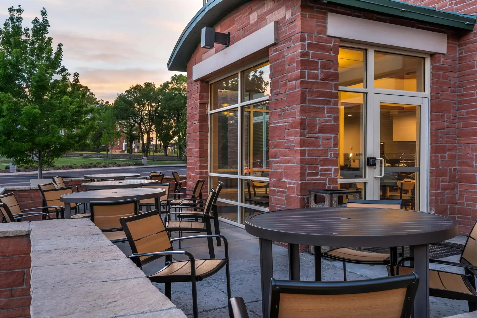
  1. Drury Plaza Hotel FlagstaffPhoto: Expedia

    1 / 7

    Breakfast and parking freeMilton Road and NAU 9.6/10 on Expedia

    Drury Plaza Hotel Flagstaff

    Free parkingPets: dogs and cats, up to 2, up to 40 lb eachBreakfast included

    About 15 miles from the Snowbowl trailheads, with free breakfast from 6 am on weekdays before an early start, and free parking.

    • Good for Families: breakfast, the evening reception and parking are free
    • Good for An indoor pool and hot tub in winter
    • Skip if Your dog is over 40 lb

    Check prices on Expedia Photos, rules and fees

  • Bespoke Inn FlagstaffDowntown and Southside 9.8/10 on Expedia · 426 reviewsFree parkingPets: dogs only, up to 2Check prices
  • Residence Inn by Marriott FlagstaffDowntown and Southside 9.6/10 on Expedia · 1,002 reviewsParking $10 a dayPets: up to 2 petsCheck prices
  • High Country Motor Lodge – Near NAU/DowntownMilton Road and NAU 9.2/10 on Expedia · 3,021 reviewsFree parkingPets: up to 2 pets, up to 75 lb each, set rooms onlyBreakfast extraCheck prices

Where to stay in Flagstaff

Quick answers

What is the hardest hike in Flagstaff?

The Humphreys Trail to the top of Arizona: 5 to 5.5 miles one way with 3,420 feet of climbing, starting at about 9,300 feet. The Weatherford Trail is longer, 10.4 miles one way.

What are easy hikes in Flagstaff?

The Aspen Nature Loop at Snowbowl (1.8 miles, about an hour), Fatman's Loop on the east side of town (2.5 miles), the Rim Trail at Walnut Canyon (0.7 mile), the Lava Flow Trail at Sunset Crater (1 mile) and the 2-mile loop at Buffalo Park.

Where can you see petroglyphs near Flagstaff?

At Picture Canyon, on the northeast edge of town. The 2.8-mile Tom Moody Trail loops past Sinagua petroglyphs and a small waterfall on the Rio de Flag; the Don Weaver Trail makes a shorter loop.

Where can you hike in Flagstaff with a dog?

On the Humphreys, Kachina, Elden Lookout and Fatman's Loop trails, on a leash. Dogs aren't allowed on the Island Trail at Walnut Canyon or the Wupatki pueblo trails.

When is the best time to hike in Flagstaff?

Late spring to fall for the high trails. Snow can fall on the Peaks in any month, and July to September brings afternoon thunderstorms, so start early.

Can you hike the Inner Basin right now?

The trail is open, but Lockett Meadow Road, the only way to the trailhead, is closed to all traffic, including hikers, for construction.

Are there trails right in town?

Yes. The Karen Cooper Trail follows the Rio de Flag for 3.6 miles from downtown, and the Route 66 Trail runs 4.9 miles east along Route 66.