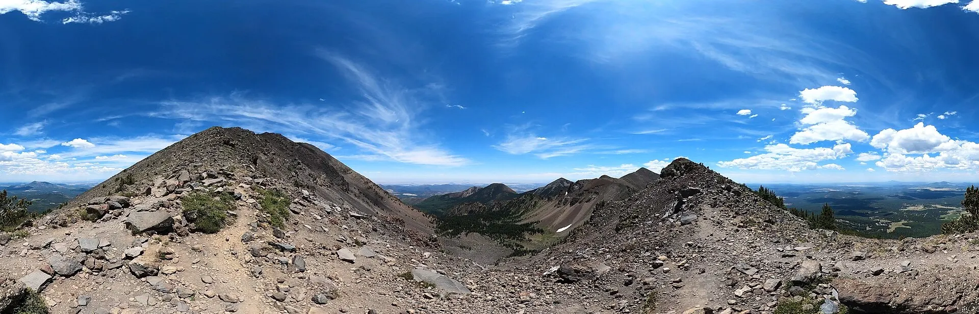
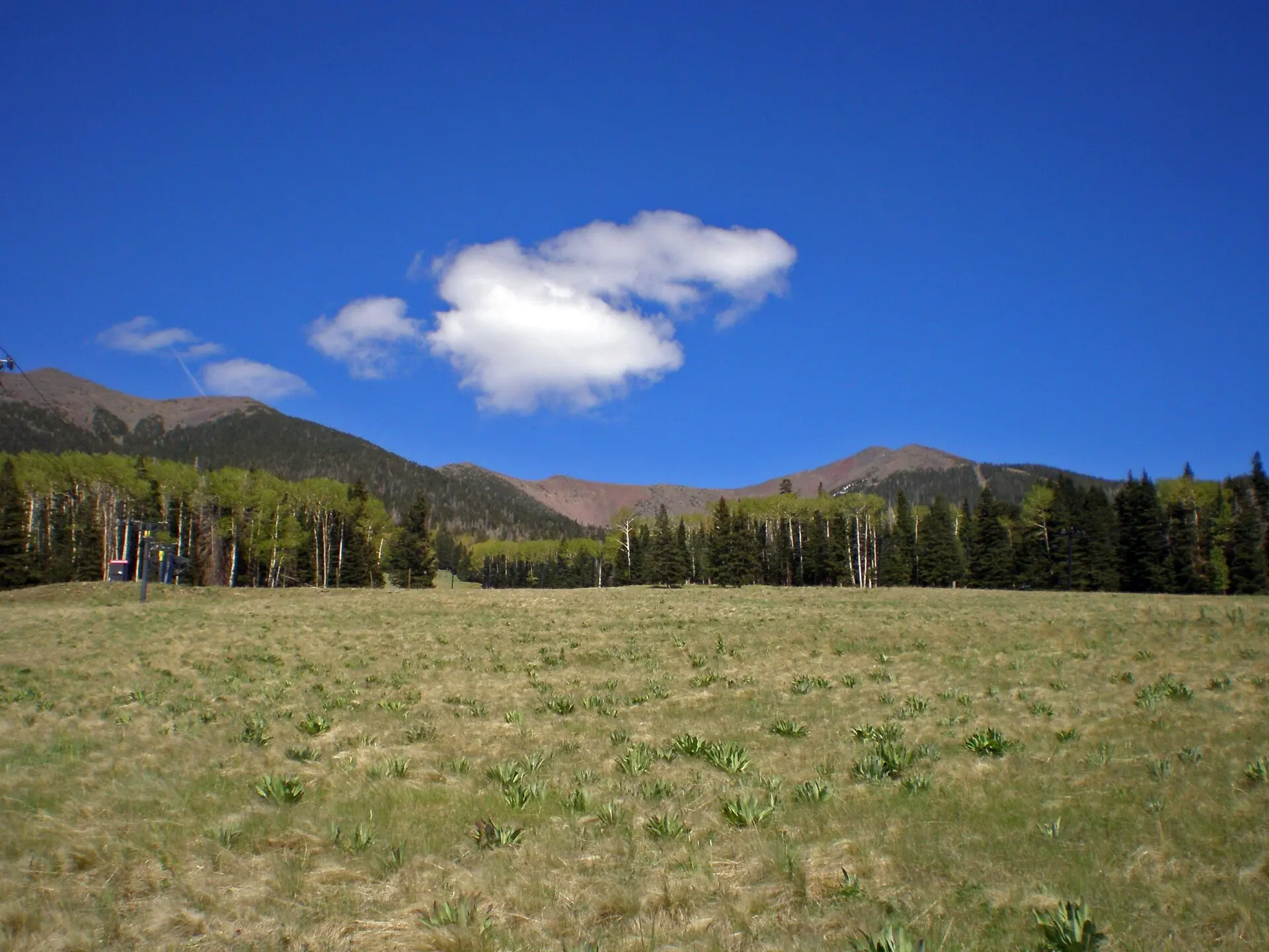
The San Francisco Peaks from the Humphreys Peak summit trail, with Humphreys Peak on the left
Humphreys Peak

Hiking Humphreys Peak

The top of Arizona is a long, very strenuous day from Flagstaff: 5 to 5.5 miles each way from Arizona Snowbowl, about 3 to 4 hours up, with 3,420 feet of climbing to 12,633 feet and a view to the Grand Canyon.

Some links on this page are affiliate links. If you book through them, we earn a commission at no extra cost to you. It doesn't change what we recommend. How we make money

Trail facts
Checked November 7, 202612,633 ft10–11 miles round trip

Humphreys Peak summit trail · Photo: Hoplophile / Wikimedia Commons, CC BY-SA 4.0 · Credits

The trail

From Snowbowl to the summit

The Humphreys Trail starts at the north end of the lower Snowbowl lot and climbs 3,420 feet to the summit. The round trip takes a full day.

The San Francisco Peaks from the start of the Humphreys Trail
The Peaks from the start of the Humphreys Trail.Humphreys Trail, Arizona Snowbowl · Photo: Brady Smith, Coconino National Forest / Wikimedia Commons, CC BY-SA 2.0
Summit
12,633 ft, the highest point in Arizona
Trail
Humphreys Trail No. 151
Length
5 to 5.5 miles one way, 10 to 11 miles round trip
Time
About 3 to 4 hours one way
Difficulty
Very strenuous: steep, long and extremely rocky near the top
Climb
3,420 ft
Trailhead
About 9,340 ft, at the north end of the lower Arizona Snowbowl parking lot
Getting there
North on US 180 for 7 miles, right on Snowbowl Road for 7.4 miles to the lower lot; about 30 minutes from downtown
Dogs
On a leash; pack out what your dog leaves
Vehicles
No motor vehicles on the trail
The route

From meadow to tundra

The climb takes you through every life zone on the mountain. The forest thins as you rise, the last trees are ancient bristlecone pines, and the final stretch to the summit ridge is open rock and tundra.

The peaks are part of the Kachina Peaks Wilderness, 18,960 acres protected since 1984 and sacred to the Indigenous peoples of northern Arizona. The Hopi say the katsinam fly from the peaks to the Hopi mesas each summer, bringing the monsoon rains.

Start
Cross a meadow from the parking lot to the edge of the forest
Forest
Alpine forest, past rock slides and avalanche tracks, with Hart Prairie below
Tree line
Bristlecone pines, twisted by wind and frost, are the last trees
Above tree line
Tundra shrubs and wildflowers among the rocks, some found nowhere else; fully exposed to wind and weather
The saddle
Where the trail meets the ridge between Agassiz Peak and Humphreys Peak. Check the sky here before going on: the rest is above tree line
False summits
The ridge rises over several false summits before the real top, with loose rock and some scrambling
Summit ridge
A 360-degree view: the Grand Canyon, the Painted Desert, the Hopi mesas, the Verde Valley and Oak Creek Canyon
Weather on the summit

Cold and wind on the ridge

A pleasant morning at the trailhead can turn cold and windy on the ridge. Bring a warm, windproof layer, and turn around if a storm is building.

Start time
Early. With 3 to 4 hours each way, you want to be off the top before afternoon storms
Layers
It can be much colder and windier above tree line than at the trailhead
Poles
Very useful on the steep, rocky upper half
Pace
The air at 9,000 to 12,600 feet is thin; expect to stop often to catch your breath
Before you go
The Kachina Peaks Avalanche Center snowpack report in winter and the San Francisco Peaks recreational forecast all year
Ranger station
Flagstaff Ranger Station, 5075 N Highway 89, 928-526-0866, weekdays 8 am to 4 pm
Weather and season

Afternoon storms

Summer storms build over the Peaks on July, August and September afternoons, so summit hikers start early and head down when the clouds stack up.

Flagstaff's elevation and altitude

Snow
Possible in any month
July to September
Thunderstorm season. If a storm builds, turn around and get to lower ground
Winter
Avalanches can run on steep slopes near and above tree line
Altitude
You start above 9,000 feet and finish above 12,600. Many visitors notice the thinner air on the first day or two in Flagstaff
Where to stay

Closest to the trailhead

Downtown and Milton Road hotels are about 14 miles from Snowbowl. For the view without the climb, the summer gondola at Snowbowl takes visitors up the mountain.

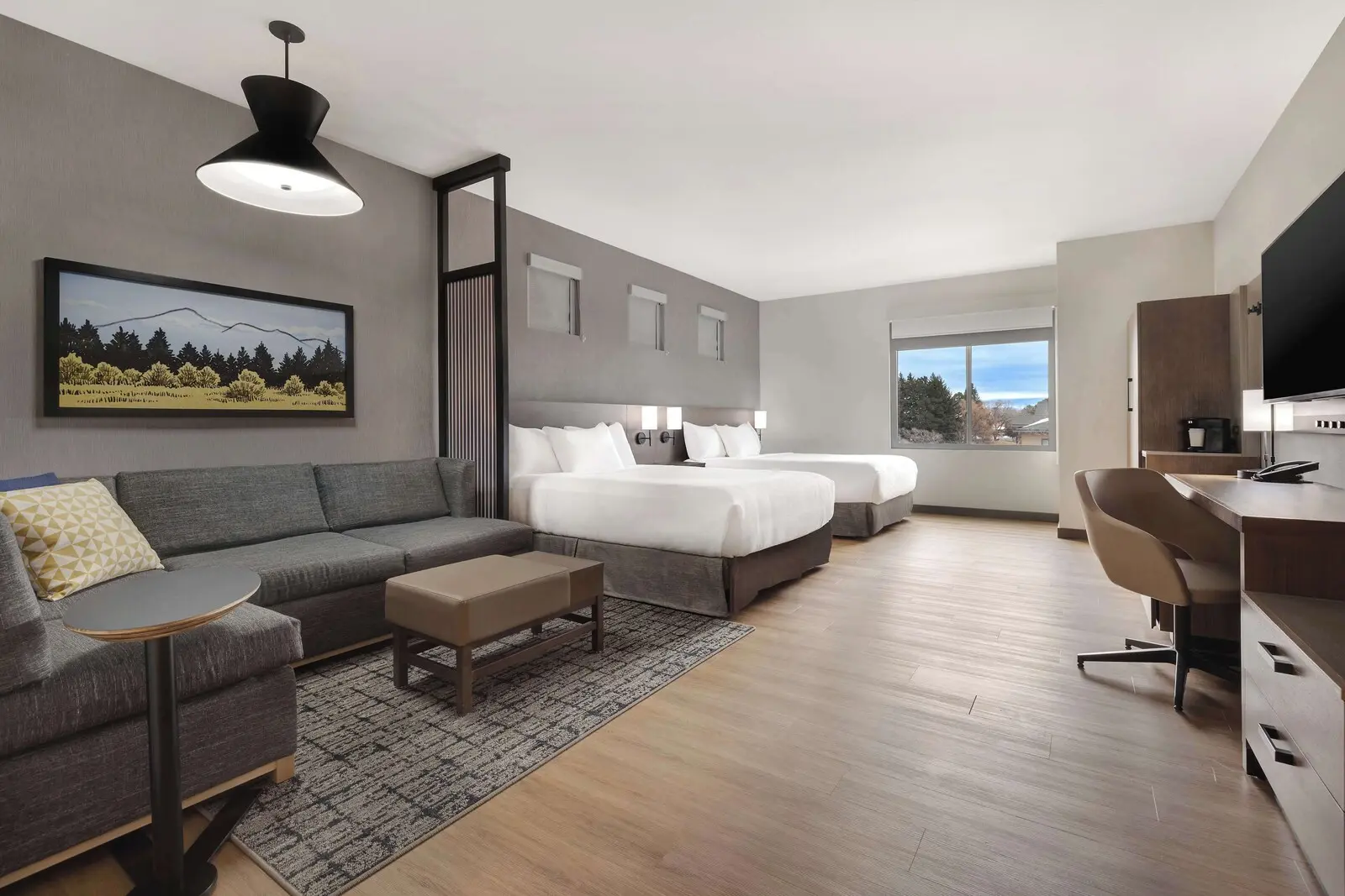
  1. Hyatt Place FlagstaffPhoto: Expedia

    1 / 7

    Indoor pool, downtown on footMilton Road and NAU 9.0/10 on Expedia

    Hyatt Place Flagstaff

    Parking $8 a nightPets: dogs only, up to 2, up to 50 lb eachBreakfast extra

    About 14 miles from the Humphreys trailhead at Snowbowl, with an indoor pool open until 10 pm after the climb.

    • Good for Couples who want to walk to downtown and NAU
    • Good for A winter stay with an indoor pool
    • Skip if You need a crib or rollaway

    Check prices on Expedia Photos, rules and fees

  • Bespoke Inn FlagstaffDowntown and Southside 9.8/10 on Expedia · 426 reviewsFree parkingPets: dogs only, up to 2Check prices
  • Hotel Monte VistaDowntown and Southside 8.0/10 on Expedia · 1,057 reviewsParking $50 a day in a nearby lot; limited spaces at the hotelNo petsBreakfast extraCheck prices
  • Residence Inn by Marriott FlagstaffDowntown and Southside 9.6/10 on Expedia · 1,002 reviewsParking $10 a dayPets: up to 2 petsCheck prices

Snowbowl's summer gondola More Flagstaff hikes

Quick answers

How long is the Humphreys Peak hike?

5 to 5.5 miles each way, so 10 to 11 miles round trip, with 3,420 feet of climbing.

Can a beginner hike Humphreys Peak?

Only if you're fit and well prepared. The Forest Service rates it very strenuous: 10 to 11 miles round trip, 3,420 feet of climbing, thin air and loose rock on the ridge. Start early, turn back at the saddle if storms build, and try a shorter trail first if you've just arrived from low elevation.

What are the false summits on Humphreys Peak?

Above the saddle, the ridge climbs over several bumps that look like the top from below. The real summit comes after them; expect loose rock and a little scrambling.

How tall is Humphreys Peak?

12,633 feet, the highest point in Arizona.

Where does the Humphreys Peak trail start?

At the north end of the lower parking lot at Arizona Snowbowl, about 14 miles from downtown Flagstaff.

Can you hike Humphreys Peak in winter?

In winter the upper trail is avalanche terrain: slides can run on steep slopes near and above tree line. Snow is possible in any month.

How long does it take to hike Humphreys Peak?

About 3 to 4 hours one way, so the round trip fills a full day.

How hard is the Humphreys Peak hike?

Very strenuous: 3,420 feet of climbing over 5 to 5.5 miles, starting above 9,000 feet, and extremely rocky in the upper part.

What can you see from the top of Humphreys Peak?

On a clear day, the Grand Canyon, the Painted Desert, the Hopi mesas, the Verde Valley and Oak Creek Canyon.

Can you bring a dog up Humphreys Peak?

Yes, on a leash. Pack out what your dog leaves.